Millions of residents across the South are facing renewed flood threats this week following a soggy Memorial Day weekend, with approximately 15 million people under flood alerts stretching from Louisiana to Georgia. The National Weather Service has issued warnings as heavy rains and thunderstorms are expected to dump up to 2 inches of precipitation in some areas, raising concerns about flash flooding in multiple states.
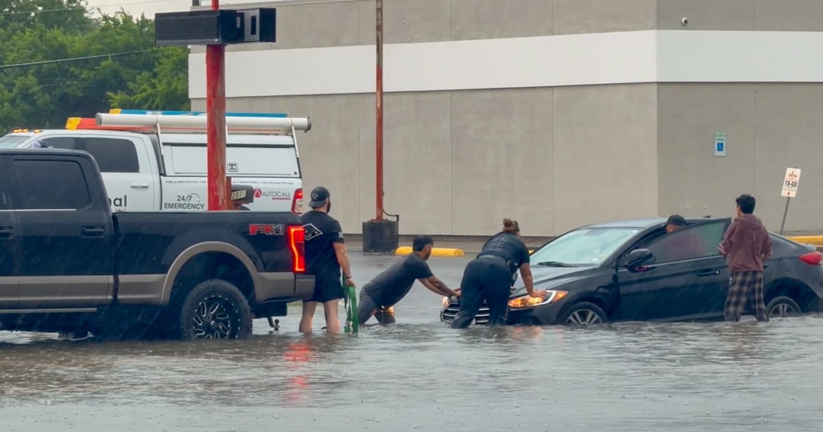
According to reports from NBC News, excessive rainfall is also forecast to impact regions from the Carolinas to western Texas. In parts of southwest Texas, including Midland and Fort Stockton, conditions could produce large hail, damaging winds, and a few tornadoes. Pictures and videos from the holiday weekend already showed flooded driveways in Mississippi and stranded cars in the Dallas-Fort Worth metroplex after several inches of rain fell.
A flood watch remains in effect for New Orleans until 7 p.m. local time Tuesday. Showers and storms are anticipated to continue through the evening, bringing up to an inch of rain generally, with isolated spots possibly seeing as much as 2 inches. Hourly rainfall rates of 1 to 3 inches are possible, which could lead to flash flooding even in areas outside the official watch zone.
Atlanta is similarly under a flood watch until 11 p.m. local time Tuesday, with forecasters expecting between 0.75 and 1.25 inches of rain and up to 2 inches in isolated locations. Officials have noted that the combination of saturated ground from the weekend and additional downpours increases the risk of localized flooding in urban areas.
The broader pattern of precipitation is expected to persist throughout the week across the affected region, though exact rainfall totals remain to be determined as the system evolves. Residents in low-lying areas and near rivers are being urged to monitor updates from local emergency management offices.
Video footage shared over the weekend captured the extent of the initial impacts, with vehicles navigating through high water in the Dallas-Fort Worth area and standing water covering roads in Mississippi. These scenes underscore the challenges communities face when multiple rounds of storms arrive in quick succession.
Meteorologists have highlighted that the South has seen repeated rounds of moisture-laden systems this spring, contributing to the current elevated flood risk. The Memorial Day weekend brought widespread showers that left many areas with little recovery time before Tuesday's expected activity.
Authorities in both New Orleans and Atlanta have activated monitoring protocols, with public works departments prepared to respond to any reports of street flooding or drainage issues. Residents are advised to avoid driving through flooded roadways and to have emergency supplies on hand.
Further west, the potential for severe thunderstorms in Texas adds another layer of concern, as the same atmospheric setup fueling heavy rain could also spawn strong winds and hail. The National Weather Service has issued statements covering those hazards for the affected counties.
As the week progresses, additional showers are likely to move through the Southeast and into parts of the Midwest, though the heaviest concentrations are currently focused on the southern states. Updates will continue to be issued as conditions change.
Communities that experienced flooding over the holiday weekend are particularly vulnerable, with some local officials reporting that drainage systems are still clearing excess water from earlier storms. Coordination between state and federal agencies is ongoing to assess any needs for additional resources.
The situation remains fluid, with forecasters emphasizing that even modest additional rainfall on already wet soils can quickly lead to problems. People across the alert areas are encouraged to sign up for local weather alerts and check conditions before traveling.