In the heart of Australia's arid outback, a deluge of biblical proportions is transforming the desert into a temporary sea, catching even seasoned meteorologists off guard. Oodnadatta, known as the country's driest town with an average annual rainfall of just 172 millimeters, is bracing for up to two years' worth of precipitation in a single week, according to forecasts from weather experts. Heavy rains have already lashed central Australia, with predictions of 150 to 300 millimeters falling across inland regions this week, following initial downpours in recent days.
The unusual weather event stems from a vast humid air mass originating from the tropical Top End region, pushed southward into the continent's bone-dry interior. Alice Springs, a key hub in the Northern Territory, is under a flood watch as swollen creeks and rivers threaten to overflow. The Trans-Australian rail line, vital for freight across the vast expanse, has been severed by track washouts, stranding trains and disrupting supply chains. Meanwhile, the Northern Territory's main highway remains closed, isolating remote communities and complicating emergency responses.
Severe weather warnings for heavy rain extend beyond the Northern Territory, covering parts of Queensland, New South Wales, South Australia, and Victoria. Officials have issued alerts for flash flooding triggered by intense rainfall and damaging winds from localized severe thunderstorms. Flood warnings are in effect for rivers and streams throughout the entire Lake Eyre Basin, a sprawling catchment that drains into Australia's lowest point. "The sheer scale of this event is remarkable – and concerning," notes an analysis from The Conversation, highlighting the unprecedented moisture invading one of the world's driest landscapes.
Remote Indigenous communities and pastoral stations dotting the outback could face isolation for weeks, with significant livestock losses anticipated. Western Queensland, still recovering from major floods earlier this year, is particularly vulnerable. As floodwaters gather, they are expected to funnel into the intricate network of rivers feeding Kati Thanda-Lake Eyre, the continent's largest salt lake. This could mark the second consecutive year the ephemeral lake fills substantially, an occurrence not seen since European settlement.
At its peak last year, Kati Thanda-Lake Eyre covered about 80 percent of its maximum extent and reached depths of just over 2 meters in the deepest sections, Belt Bay and Madigan Gulf. As of February 10, remnants of those floodwaters persist in many areas, remnants of torrential rains that struck western Queensland nearly a year prior. Floodwaters from distant tributaries often take months to reach the lake, meandering through parched channels. If current projections hold, the lake might surpass its historical depth record of 6 meters set in 1974, when widespread falls of 300 to 600 millimeters saturated dry catchments.
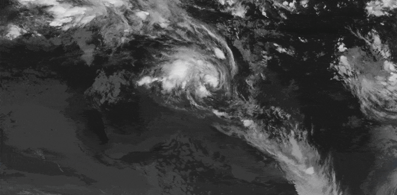
The meteorological driver behind this soaking is a slow-moving tropical low that has intensified as it drifted southeast through the Northern Territory in recent days. On its northern and eastern edges, an "incredibly humid airmass from the oceans off Indonesia" is fueling the system, according to experts. This saturated air is being drawn south by a deepening upper trough extending into northwest New South Wales, forecast to intensify on Tuesday. The interaction promises a "recipe for intense rain," as the trough lifts the moist air aloft, where it condenses into heavy downpours.
The tropical low is expected to linger almost stationary over central Australia throughout the week, prolonging the deluge before it weakens. Warmer air temperatures, capable of holding more moisture, exacerbate the situation—for every degree Celsius of warming, the atmosphere can retain about 7 percent more water vapor. This principle underlies the potential for even more extreme short-duration bursts during thunderstorms.
Historical precedents for such events are rare. Since European colonization, Kati Thanda-Lake Eyre has filled to near or full capacity only four times, with the most recent substantial filling occurring in 2025. Each prior filling has coincided with strong La Niña conditions in the Pacific Ocean, which typically deliver cooler, wetter weather to eastern and central Australia. Last year's partial filling happened during a moderate La Niña phase. However, the current La Niña is rapidly weakening, with an El Niño—associated with hotter, drier conditions—likely to emerge soon.
This disconnect from traditional patterns raises questions about predictability. "It’s getting harder to project what’s likely to happen based on past experience," the analysis observes, pointing to already elevated river levels in northern parts of the Lake Eyre Basin before this system arrived. Many streams were at minor or moderate flood stages, primed for overflow from the incoming rains.
Beyond the immediate chaos, the event underscores shifts in Australia's water cycle amid global heating. The world is now 1.48 degrees Celsius warmer than pre-industrial levels, largely due to fossil fuel emissions, supercharging evaporation and precipitation extremes. "One of the most visible and devastating changes from global heating is what’s happening to the global water cycle," experts explain, noting that extreme rains and floods are occurring more frequently worldwide.
While direct attribution to climate change for this specific event requires further study, the broader trends are unequivocal. Increased atmospheric moisture loads the dice for intensified downpours, particularly in regions like central Australia that rarely see such volumes. For residents in desert towns like Oodnadatta and Coober Pedy, the focus remains on survival. Emergency services urge preparation, with sandbagging and evacuation plans in place for low-lying areas.
In Alice Springs, local authorities reported over 100 millimeters of rain in the past 24 hours as of Monday, surpassing monthly averages. "We're seeing water where we haven't in decades," said a spokesperson for the Northern Territory Emergency Service, emphasizing the need for caution on flooded roads. Stock losses in the pastoral industry could run into the thousands, compounding economic pressures in an already drought-prone sector.
Looking ahead, the tropical low's persistence could extend impacts into the weekend, with models showing continued moisture influx from the north. Rivers like the Cooper Creek and Diamantina, key feeders to Lake Eyre, are swelling rapidly. If inflows match 1974 levels, the lake's transformation from salt flat to inland sea could boost bird migrations and temporary wetlands, offering ecological windfalls amid the disruption.
For the dryland communities bracing for the onslaught, the rains bring both peril and paradox. "For the dryland and desert towns, communities and stations bracing for impact, this will be small comfort," the experts caution. "It’s crucial we don’t underestimate these rains. They are packing a punch." As floodwaters spread, the event serves as a stark reminder of nature's unpredictability in a changing climate, with long-term monitoring essential to gauge the full toll.
In the coming weeks, assessments will track the lake's filling and regional recovery. Western Queensland's earlier floods this year, which displaced hundreds and damaged infrastructure, provide a grim template. Aid organizations are mobilizing, but the remoteness poses logistical challenges. Ultimately, this desert drenching highlights the fragility of Australia's interior, where extremes swing from dust to deluge with little warning.