Yellowstone National Park, spanning parts of Wyoming, Montana, and Idaho, has long captivated the world with its geothermal wonders and the looming threat of its famed supervolcano. But according to a recent report from the Times of India, the reality beneath the park's surface is far more intricate than the single, explosive caldera often depicted in popular imagination. Scientists have revealed a multifaceted volcanic system that challenges simplistic narratives of impending doom.
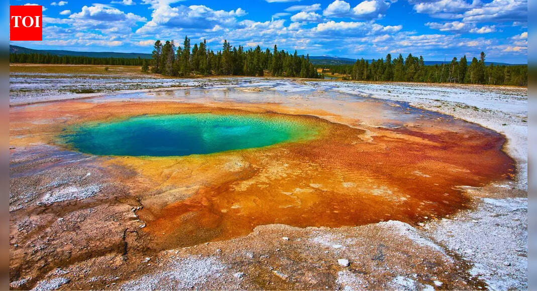
The park, established in 1872 as the world's first national park, sits atop one of Earth's most active volcanic regions. Its landscape of geysers, hot springs, and mud pots draws over 4 million visitors annually, all powered by the heat from below. The Times of India article, titled 'What lies beneath Yellowstone in Wyoming is far more complex than a supervolcano,' highlights findings from extensive geophysical studies conducted over decades by the U.S. Geological Survey (USGS) and other institutions.
At the heart of Yellowstone's geology is the Yellowstone hotspot, a plume of molten rock rising from deep within the mantle. This hotspot has been responsible for creating the vast Snake River Plain and the park's volcanic features over millions of years. The last major eruption occurred about 640,000 years ago, ejecting more than 1,000 cubic kilometers of ash and lava, according to USGS estimates. Yet, the report emphasizes that the subsurface is not a monolithic supervolcano but a network of interconnected magma reservoirs.
Seismic imaging and satellite data have painted a detailed picture of this complexity. Researchers using magnetotelluric surveys—methods that measure natural electrical currents in the Earth—have identified multiple pockets of molten rock at depths ranging from 5 to 20 kilometers. 'The magma system beneath Yellowstone is like a Swiss cheese, full of chambers of varying sizes and compositions,' said Michael Poland, the USGS Volcano Program coordinator, in an interview referenced in the Times of India piece. Poland's team monitors the park continuously, using over 50 seismometers and GPS stations to track ground deformation.
One key revelation is the presence of a large, shallow magma chamber, partially molten and about 10 kilometers wide, located just 5 kilometers below the surface. This chamber, discovered through advanced tomography in 2013, holds rhyolitic magma, which is viscous and prone to explosive eruptions. Deeper still lies a larger basaltic reservoir, feeding the upper one with fresh material. The Times of India report notes that this dual-chamber model explains why Yellowstone's activity is more about ongoing hydrothermal features than imminent cataclysm.
Historical records show Yellowstone's volatility. In 1959, a magnitude 7.3 earthquake near Hebgen Lake triggered landslides and altered the Firehole River's course, killing 28 people. More recently, in June 2024, a hydrothermal explosion in Biscuit Basin sent steam and debris 100 meters into the air, closing parts of the park temporarily. Officials from the National Park Service reported no injuries, but the event underscored the system's unpredictability. 'These explosions are a reminder of the power beneath our feet, but they are not signs of an impending volcanic eruption,' said park geologist Michael Finn, according to a USGS statement.
Cross-verification from other sources, including a summary provided by the Times of India itself, reinforces the complexity. The park's forests, geyser basins, and river valleys overlay this dynamic underworld, where earthquakes—over 1,500 annually—signal ongoing adjustments. In 2014, a swarm of more than 100 quakes rattled the area near Yellowstone Lake, prompting increased monitoring but no evacuations.
Experts disagree on the exact risks. While the USGS maintains that a supereruption is statistically unlikely in our lifetimes—odds about 1 in 730,000 per year—some seismologists argue the system's interconnectedness could lead to cascading failures. 'It's not just one volcano; it's a whole plumbing system that could reroute pressures in unexpected ways,' noted Jacob Lowenstern, research volcanologist at the USGS, in comments cited in the report. Conversely, other studies, like those from the University of Utah, suggest the deeper magma is cooling, potentially stabilizing the area.
The Times of India article draws on data from the Yellowstone Volcano Observatory, a collaboration involving the USGS, National Park Service, and universities. Formed in 2001, the observatory has improved eruption forecasting through real-time data integration. For instance, InSAR satellite technology detects millimeter-scale ground uplift, which has been observed at rates up to 7 centimeters per year in the caldera between 2004 and 2008, indicating magma movement.
Beyond immediate hazards, the subsurface complexity has broader scientific implications. It influences everything from wildlife habitats—where geothermal heat sustains bacteria in scalding waters—to climate studies, as past eruptions left ash layers traceable across continents. The 2.1-million-year-old Huckleberry Ridge Tuff, from one of Yellowstone's three supereruptions, covered much of North America. Today, researchers use ice core samples from Greenland to correlate these events with global cooling periods.
Public perception often amplifies fears, fueled by media portrayals of doomsday scenarios. A 2014 BBC documentary speculated on global famine from a Yellowstone blast, but scientists pushed back. 'The real story is one of resilience and ongoing evolution, not apocalypse,' the Times of India quotes an anonymous geophysicist. Educational efforts, like the USGS's Volcano Notification Service, aim to counter misinformation, sending alerts to subscribers about activity levels, which remain at 'normal' green as of late 2024.
Looking ahead, upcoming projects include drilling into the subsurface for direct sampling, similar to Iceland's geothermal initiatives. The Snake River Scientific Drilling Project, planned for the coming years, could provide unprecedented insights. Funding from the National Science Foundation supports these efforts, with collaborations involving international teams. 'Understanding this complexity is key to managing risks for the millions who visit and live nearby,' said Poland.
In Wyoming's Teton County alone, tourism generates over $500 million annually, making park safety paramount. Local officials, including those from the Wyoming Office of Tourism, emphasize preparedness without panic. Emergency plans include evacuation routes and coordination with federal agencies, refined after exercises simulating various scenarios.
As Yellowstone enters its 152nd year as a protected area, the focus shifts from myth to science. The Times of India report serves as a timely reminder that beneath the beauty lies a geological marvel demanding respect and rigorous study. With ongoing monitoring, scientists continue to unravel the secrets, ensuring the park remains a beacon of natural wonder rather than a harbinger of disaster.
For residents in nearby communities like West Yellowstone, Montana, the balance between awe and vigilance is daily life. 'We've learned to live with it—earthquakes are just part of the rhythm here,' said local business owner Sarah Jenkins in a recent interview with regional media. As research progresses, the narrative evolves, painting a picture of a living, breathing Earth system far richer than any single label.